

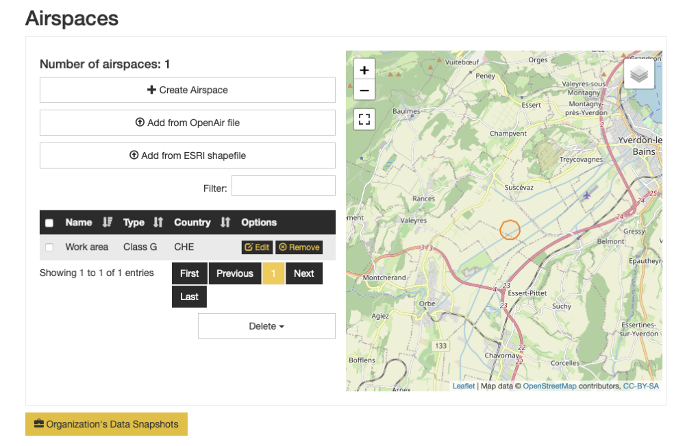
Airspaces#
You may import Airspaces in OpenAir or Shapefile, or create them using our editor.
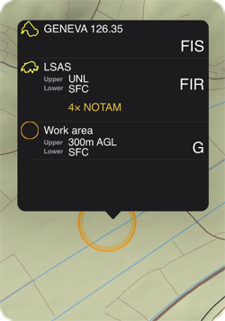
As seen in Air Navigation Pro#
Access#
Create and Edit#
On creation or edition, you are presented with a map view. You may use the drawing option on the left: circle and polygon. A circle is stored as a polygon.
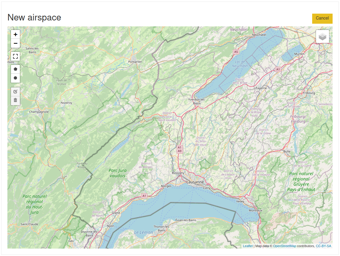
One the geometry is defined, you will be able to set details.
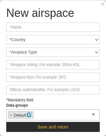
Note
The airspace floor and ceiling accept units in feet and meters.
You may also change the geometries by selecting the  button and then dragging individual points.
You may remove a point by selecting it and pressing the delete key. You may remove the entire geometry by clicking
on the
button and then dragging individual points.
You may remove a point by selecting it and pressing the delete key. You may remove the entire geometry by clicking
on the  icon.
icon.
The default data group is preselected for convenience. Click on the field to reveal the other groups.
Importing data#
You may import data using 2 formats: Shapefile and OpenAir. In either case, the supported airspace classes are
Classes |
Meaning |
|---|---|
A |
Class A |
B |
Class B |
C |
Class C |
D |
Class D |
E |
Class E |
F |
Class F |
G |
Class G |
CTR |
CTRs |
DANGER |
Danger |
RESTRICTED |
Restricted area |
PROHIBITED |
Prohibited area |
TMZ |
Transponder mandatory |
TSA |
Temp Segregated Area |
TRA |
Temp Restricted Area |
MATZ |
MATZ |
RECREATIONAL |
Recreational |
NATURE_RESERVE |
Nature reserve |
FIR |
FIR boundary |
Shapefile#
This is a fairly old format but very well supported by multiple GIS tools. We would recommend QGIS as we use it on a regular basis (and it’s free).
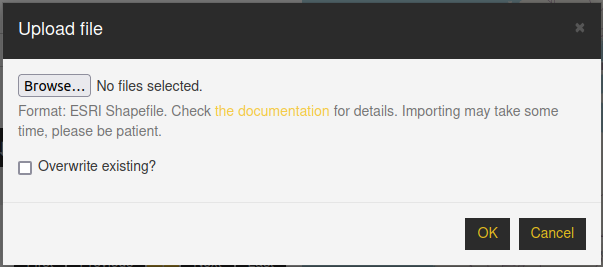
When clicking on Browse, please select all the related files for your shapefile. You may import either a Zip file containing the shapefile data, or you may import the individual Shapefile items. In that case, there must be at least files with the following extensions:
shp
shx
dbf
In addition you may have a file with extension prj containing the projection used. If the file is not provided, the projection will be assumed to be EPSG:4326, also known as WGS86 (longitude/latitude).
Note
If the Overwrite checkbox is left unchecked, existing airspaces will be left untouched.
Supported geometry types#
Only simple polygons are supported. This means holes are ignored.
Note
Shapefiles only support one geometry type per file: it is not possible to store points and polygons in the same file.
Note
Shapefiles do not support circles and arcs, you will need to create a circle approximation as a polygon.
Fields#
The following fields are mandatory:
- NAME
The airspace name. 100 characters
- CLASS
Among the list above.
- COUNTRY
3 letter ISO code. E.g. CHE for Switzerland, FRA for France, DEU for Germany, etc.
The following fields are optional:
- FLOOR
The lower limit of the airspace. 50 characters max. Use SFC for ground (default). Default reference is MSL. Use AGL for ground level reference. Attach unit (ft/m) for proper handling in the app. E.g. SFC, 100m MSL, 5000ft AGL are acceptable values.
- CEILING
The upper limit of the airspace. 50 characters max (default=100m AGL). Default reference is MSL. Use AGL for ground level reference. Attach unit (ft/m) for proper handling in the app. E.g. 1000m MSL, 5000ft AGL.
- ID
In case the airspace has an ICAO identifier.
Note
In case the file you provide does not contain the expected field, the interface will be extended to provide mapping utilities as well as means to set default values for all the entries:

Attention
Beware that if the resulting floor/ceiling make the surface below ground (e.g. use incorrect MSL in mountainous areas) the airspace is never displayed.
Warning
The geometries may not cross the antimeridian: this causes rendering and editing issues.
OpenAir#
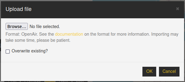
Please refer to the OpenAir documentation for details about the expected data structure. The advantage for this format is the storage of circles and arcs. The Shapefile format does not support those: they must be replaced by polygons.
Note
Our database and app do not handle circles (center + radius) nor arcs, they are always approximated by polygons.
Mind the following caveats:
Floor and ceiling are by default specified in feet, and the default reference is MSL.
To specify something different, please use the following syntax: 1500m AGL for 1500m above ground level. Use 500ft MSL to specify 500 feet above mean sea level.
Ground level is specified using SFC.
If airspace ceiling is unlimited, use UNL.
Polygons must be ‘valid’ in the sense of John R. Herring, Ed., “OpenGIS Implementation Specification for Geographic information - Simple feature access - Part 1: Common architecture,” Oct. 2006.
The geometries may not cross the antimeridian, or have points whose longitude are more than 180 degrees apart. This causes rendering issues.
Supported airspace classes (in the AC field) are given above.
Note
If the Overwrite checkbox is left unchecked, existing airspaces will be left untouched.
After creation, edition or import#
The airspaces are automatically added to the default data group when importing the data from
Shapefile or OpenAir, while it’s added to the data group of your choice when creating/editing. If you need to change the
association, you may select the airspaces via their checkbox, and click on  below the table. You are then
presented with the following:
below the table. You are then
presented with the following:
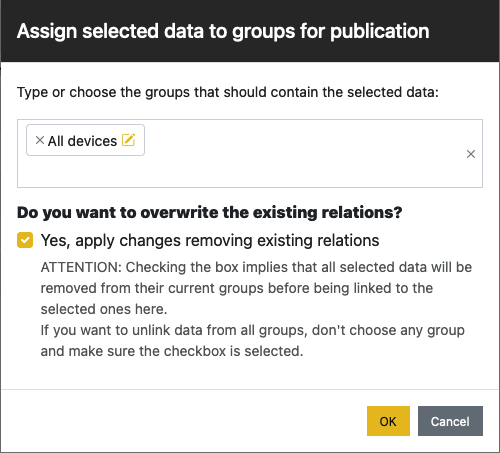
Publish#
You need to publish a data group to make the airspaces visible in Air Navigation Pro.